Significant Gravel Bars Middle Mississippi River (2012 Low Water Photos)

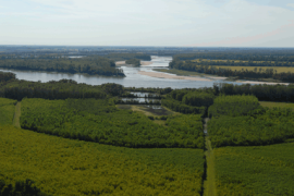
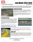
During the annual low water inspection flight in 2012, significant gravel and cobble deposits were noticed at 6 locations. The photos in this PDF show those locations from both air and the ground. Other photos of sandbars were also included to show the noticeable difference in color between sand and gravel bars from the air. Some of the gravel deposits appeared to be recent due to the leading edge of gravel waves at the lower ends of the some of the bars that appeared to be covering previous deposits of sand and old vegetation

http://mvs-wc.mvs.usace.army.mil/arec/Reports_Geomorphology.html

Significant Gravel Bars Middle Mississippi River (2012 Low Water Photos)

Geomorphology Reports – Thompson Bend

Thompson_1Beginning in 1980 the St. Louis District Corps of Engineers, local land owners, and other organizations teamed together in an effort to prevent a cut off from occurring across the neck of the Dry Bayou – Thompson Bend peninsula along the Mississippi River. The creation of a riparian buffer at key locations along with management plans and some other repairs were implemented in an effort to force the Mississippi River to maintain its current course. The continuation of this project has proven to be successful, validating the idea of a riparian corridor does work to control over bank scour and river cutoffs.

Download the report here: Thompson Bend Report

Supplimental Investigation of the Effects of River Training Structures on Flood Stages

This is a two-dimensional numerical model study performed by the Iowa Institute of Hydraulic Research.  This study looks at the impacts of some of our training structures located in the Mississippi River in the St. Louis Harbor area.  The results indicate that these structures do not raise flood heights, and their influence on water surface elevations are no more than the effects experienced from the natural variability changes in the riverbed.  Any specific questions may be addressed to Mr. Edward Brauer (314-865-6332) or Mr. Don Duncan (314-331-8809) of MVS.

Download Here:

IIHR_rivertrainingSTL_20121213

Vancill Towhead HSR Model Report

The U.S. Army Corps of Engineers, St. Louis District, conducted a sedimentation improvement study of the Mississippi River at Vancill Towhead from River Mile (RM) 72.0 to RM 65.0. This study was funded by the Regulating Works Project for the Middle Mississippi River and Avoid and Minimize (A&M) Program. The objective of the model study was to produce a report that outlined the results of an analysis of various river engineering measures, intended to reduce or eliminate the need for repetitive channel maintenance dredging between RM 68.00 and RM 67.00 and enhance the environmental diversity at Vancill Towhead without negatively affecting the navigation channel.

Click here to see more details

Environmental Benefits of Mississippi River Dikes

The Mississippi River is about 2320 miles long and, together with the Ohio and Missouri Rivers, drains all or parts of 31 states and two Canadian provinces. Long before there were railroads or interstate highways the Mississippi was the major avenue of commerce in the central United States. Barges are the most efficient form of commercial shipping; water transportation moves 16% of the nation’s freight for 2% of the freight cost…

Click on the link below for full report

Mississippi River Dikes Inland Port 2012 No.4

Birds Point HSR Report


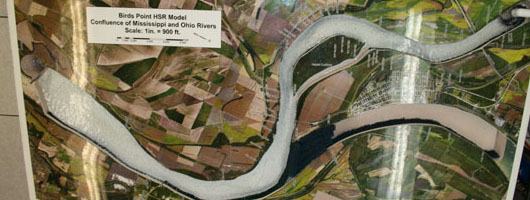
The U.S. Army Corps of Engineers, St. Louis District, conducted a study of the flow and sediment transport conditions on the Mississippi River near Bird’s Point between River Miles (RM) 5.8 and 0.0 near Cairo, Illinois. This study was funded by the Regulating Works Project for the Middle Mississippi River.  The objective of the model study was to produce a report that outlined the results of an analysis of various river engineering measures, intended to reduce or eliminate the need for repetitive channel maintenance dredging between RM 3.0 and RM 0.0 without negatively affecting the navigation conditions near RM 2.0 to RM 1.0.

Download Report Here

Download Report Plates Here

View Report as HTML Here